At Navilan Solutions, we offer a comprehensive suite of geospatial solutions designed to empower your organization with actionable insights. We leverage cutting-edge remote sensing techniques, advanced Geographic Information Systems (GIS), and expert spatial analysis to address your unique challenges across various industries.
Geodata Analysis:
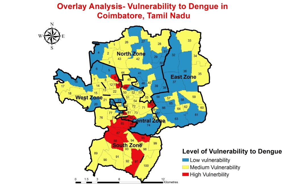
Geodata analysis involves processing and interpreting geographic data to extract meaningful insights. It encompasses tasks like spatial modeling, mapping, and identifying patterns in geographical information.
Techniques include GIS (Geographic Information Systems), Remote Sensing, and Spatial Statistics.
Applications range from Environmental Monitoring to Urban Planning and Disaster Management.
Earth Observation Analysis:
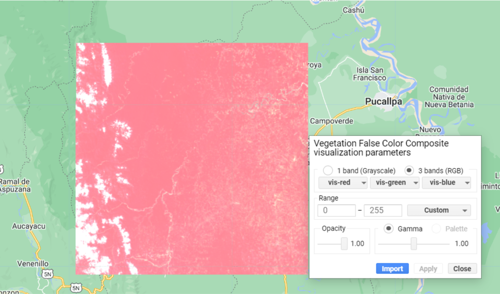
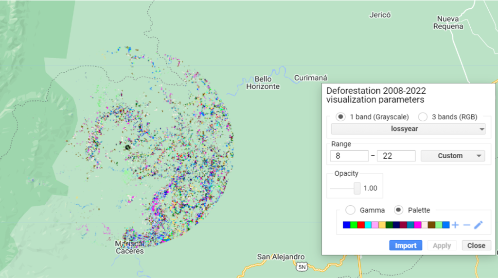
Earth observation refers to collecting data about our Earth using satellites and other instruments.
Analysis of Earth observation data involves studying land cover, climate, ocean currents, and natural phenomena.
Applications include weather forecasting, agriculture, forestry, and environmental monitoring.
Future Climate Prediction:
Climate prediction aims to forecast long-term climate trends based on historical data and scientific models.
Climate models simulate interactions between the atmosphere, oceans, land, and ice to predict future climate conditions.
These predictions are crucial for understanding climate change impacts and informing policy decisions.
Customized Geospatial solutions
We tailor our solutions to your specific needs, offering a range of services.
We leverage cutting-edge technology to develop user-friendly web and mobile applications, providing interactive access to geospatial data.
Are you looking for any of the solutions?
we offer a comprehensive suite of geospatial solutions designed to empower your organization with actionable insights